Product Spotlight: Benthos PSA-916 Altimeter
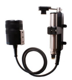
0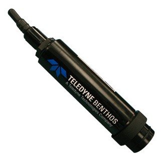 The PSA-916 Programmable Sonar Altimeter is a low-cost, lightweight altimeter designed for a wide range of marine applications. It provides high-resolution altitude/range data via a direct serial interface.
Currents and other forces can cause sediment to shift, changing the shape of the sea floor. The compact Benthos PSA-916 sonar altimeter provides accurate distance-to-bottom measurements relative to a fixed position.
The altimeter transmits a narrow-beam acoustic signal then measures the round trip time for the sound pulse to travel from the transducer through the water, reflect off a surface, and return to the transducer. Since the nominal speed of sound through water is known (1,500 meters per second), the pulse’s travel time can be used to calculate the total distance from the altimeter to the bottom of a water body.
Designed for submersible and harsh marine conditions, the altimeter is constructed of a hard anodized, marine-grade aluminum housing. It is electronically isolated to eliminate any potential signal interference with host instrument sensors. The 200 kHz operating frequency achieves accurate measurements to 6,000 meter depths.
Applications include wave height measurement, obstacle avoidance, shallow water surveys, ice thickness, sediment transport, and scour studies.
The sensor includes a built-in RS-232 serial output for interfacing with NexSens iSIC and SDL data loggers. Sensor cables can be factory-connectorized with NexSens underwater connectors for integration to an SDL submersible data logger sensor port. Data can be accessed via direct-connect, landline phone, cellular, radio, Ethernet, Wi-Fi, and satellite telemetry.
To learn more about the Benthos PSA-916, call Fondriest Environmental at (888) 426.2151, email customercare@fondriest.com, or visit http://www.fondriest.com/products/benthos_007601.htm


