Research Brief: Chloride Trends in Ontario’s Surface and Groundwaters
0High chloride concentrations can be found in waterways throughout the Great Lakes and nearby Ontario surface and groundwaters. Runoff, the increased use of road salt, and other anthropogenic stressors have led to increases in chloride concentrations throughout the region. Ontario surface and groundwaters provide important ecosystem services and contribute to the larger Great Lakes Basin.

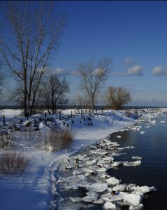
Winter in Lake Ontario (Credit: Tony Fischer via Flickr CC BY 2.0)
A 2022 report published by the Journal of Great Lakes Research compiled data from various research institutions in and near Ontario to identify chloride trends. The goal of the study was to develop a better understanding of what influences chloride trends and dynamics in Ontario waters.
Methods
The Ontario Ministry of the Environment, Conservation and Parks amassed a large data pool “on [chloride] concentrations in the Laurentian Great Lakes, inland lakes, streams, rivers and groundwaters dating back to the 1960s from over 2,500 monitoring stations representative of the diverse land use and physiographic features of the province of Ontario.”1
The report integrated research and datasets from various local agencies to spot chloride trends in the Laurentian Great Lakes and Ontario’s inland lakes, streams, and groundwaters. Data was compiled from the Provincial (Stream) Water Quality Monitoring Network (PWQMN), Lake Partner Program (LPP), Ontario Ministry of Northern Development, Mines, Natural Resources and Forestry (MNDMNRF), and Provincial Groundwater Monitoring Network.
Three analytical methods were used to measure chloride concentrations. All of the samples collected by the Great Lakes programs and the PGMN and PWQMN were analyzed using colorimetric methods by MECP Laboratory Services Branch.2 All remaining inland lake and river monitoring programs (except Lake Simcoe) used ion chromatography for analysis. Finally, “samples collected from intake pipes of drinking water facilities in Lake Simcoe and at the lake outflow were analyzed according to MECP methods, and samples collected in the lake were analyzed according to MECP.”1
Results

Lake Ontario Sunset (Credit: Mustang Joe via Flickr Public Domain)
Results of the study were divided up based on the four studied categories. For streams and rivers, the PWQMN data showed increasing chloride concentrations from the 1960s to 2019 with higher concentrations in developed and urban areas.
Inland lake results indicate that lakes with the highest chloride concentrations were usually near urban centres, adjacent to highways, and tended to be in more populated regions of the province.1 Similarly, the Laurentian Great Lakes data revealed higher concentrations in more populated and developed basins like Lake Erie and Ontario, with Lake Superior showing the lowest concentrations.
Ultimately, the study concludes with two key findings. First, chloride concentrations in Ontario surface and groundwaters are highest in developed areas with higher populations, and these concentrations are increasing. Second, based on the trend analysis and comparing data from the 1960s to 2019, chloride concentrations are increasing.
In order to prevent the decline of natural water sources, urban runoff and the use of road salt must be reconsidered in order to prevent the further salinization of Ontario’s waters.
Source
-
- Ryan J. Sorichetti, Melanie Raby, Claire Holeton, Nadine Benoit, Lucas Carson, Anna DeSellas, Ngan Diep, Brie A. Edwards, Todd Howell, Georgina Kaltenecker, Chris McConnell, Clare Nelligan, Andrew M. Paterson, Vasily Rogojin, Nure Tamanna, Huaxia Yao, Joelle D. Young. 2022. Chloride trends in Ontario’s surface and groundwaters. Journal of Great Lakes Research, Volume 48, Issue 2. Pages 512-525, ISSN 0380-1330, https://doi.org/10.1016/j.jglr.2022.01.015.
- Ministry of the Environment, Conservation and Parks. 2020b. The Determination of Chloride in Drinking Water, Surface Water, Sewage, and Industrial Waste by Colourimetry. E3016. Revision 3, February 28, 2020. 25 pp


